4-FUN – Demonstration and exploitation of most promising prototypes and tool derived from European resarch actitivities
![]()
4-FUN is a 3-year Integrated Project (2002-2015) funded within the European 7th Framework Programme and involving 14 partners from 9 European countries.
The assessment of risks to human health from chemicals is of major concern for policy and industry and ultimately benefits all citizens. In this process, exposure assessment is generally considered to be the weakest point, as currently available tools show major flaws:
(a) lack of integrated approach for assessment of combined stressors (i.e. a number of potential pollutants);
(b) widespread use of worst-case scenarios leading to over-conservative results;
(c) lack of uncertainty/sensitivity tools that allow identifying the important exposure drivers.
To overcome these drawbacks, the FP6 project 2-FUN produced prototype software containing a library of models for exposure assessment, coupling environmental multimedia and pharmacokinetic models. The objective of the 4FUN project is to further improve and standardise the 2-FUN tool and guarantee its long term technical and economic viability. Stakeholder requirements will be identified and an analysis of the strengths, weaknesses, opportunities and threats (SWOT) of existing exposure assessment tools (including 2-FUN) will be conducted. The 2-FUN tool will be subject to a rigorous standardisation which includes verification, benchmarking, documentation and demonstration. To demonstrate the reliability of modelling estimations and the feasibility of building complex realistic scenarios, case studies based on actual datasets will be performed. Improved and standardised 2-FUN software will be delivered, together with supporting documentation and training courses.
Finally, based on detailed market research a sustainable business model will be developed. Improved exposure assessment due to the project will
(a) reinforce competitiveness by avoiding overregulation;
(b) prevent excessive adverse human health effects due to underregulation;
(c) contribute to the promotion of sustainable products/technologies;
(d) lead to homogeneous integration of exposure health concerns across the policy spectrum at the Community level.
GLOCOM: Global Partners in Contaminated Land Management
GLOCOM is an exchange program funded by the Marie Curie Actions – International Research Staff Exchange Scheme, within the Seventh Framework Programme – People.
The project’s Partners are:
- University Ca’ Foscari of Venice, Italy
- Umeå University, Sweden
- Chinese Research Academy of Environmental Sciences, China
- Beijing Normal University
The general objectives of the GLOCOM exchange program are as follows:
- Increase harmonization of methods for risk assessment and management of contaminated sites in China and EU;
- Develop solutions for management of contaminated sites in China;
- Strengthen quality of research by developing international collaborations.
This will be performed through the organization of several exchange activities in the fields of contaminated soil characterization, environmental risk assessment and decision making processes. These exchange activities aim to increase quality and mutual benefit of the transfer of knowledge between the involved researchers from EU and China, in particular through the organization of workshops and training sections and the co-participation in conference and scientific publications, with the aim of identifying common ground for future research.
KULTURisk: Knowledge-based approach to develop a cULTUre of Risk prevention
The KULTURisk project aims at developing a culture of risk prevention by evaluating the benefits of different risk prevention initiatives. This evaluation will be carried out by developing a novel methodology and referring to different types of water-related catastrophes, such as river inundations, urban flash floods, storm surges, rainfall triggered debris flows and landslides.
In order to demonstrate the advantages of prevention options, an original methodology will be developed, applied and validated using specific European case studies, including transboundary areas. The benefits of state-of-the-art prevention measures, such as early warning systems, non-structural options (e.g. mapping and planning), risk transfer strategies (e.g. insurance policy), and structural initiatives, will be demonstrated.
KULTURisk will first focus on water-related hazards as the likelihood and adverse impacts of water-related catastrophes might increase in the near future because of land-use and/or climate changes. In particular, a variety of case studies characterised by diverse socio-economic contexts, different types of water-related hazards (floods, debris flows and landslides, storm surges) and space-time scales will be utilised. Finally, the applicability of the KULTURisk approach to different types of natural hazards (e.g. earthquakes, forest fires) will also be analysed.
The main objectives of the KULTURisk project are:
- A critical and comprehensive review of static and dynamic measures to prevent water-related hazards with special focus on the importance of risk communication techniques.
- The development of a risk-based methodology for the evaluation and accounting of risk prevention measures.
- The demonstration that prevention measures are more effective from a social and economic point of view than post-disaster recovery for different types of water-related risks characterised by different temporal and spatial scales and different socio-economic contexts within Europe.
- The promotion of a culture of risk prevention by using the KULTURisk outcomes as examples to:
a) increase the risk awareness of the public via improved communication;
b) shape risk perception of inhabitants in an appropriate and responsible way; and
c) train professionals, regional authorities, officers of municipalities, consultants, academics and students to better evaluate the socio-economic benefit of risk prevention techniques for water-related risks.
In particular, our research group (Department of Environmental Sciences, Informatics and Statistics of University Ca’ Foscari Venice, under CORILA partner) is leading WP1 “Methodology to evaluate the benefits of risk prevention” and contributing to WP6 “Validation and generalisation of the methodology”.
Link: http://www.kulturisk.eu
CANTICO – Climate and local ANthropogenic drivers and impacts for the TunisIan COastal area (CANTICO)
The main objective of CANTICO is to develop a pilot study to establish a conceptual model tool to integrate the complex interaction of climate and anthropogenic impacts on vulnerable Mediterranean coastal areas. The effort will be aimed at identifying an effective approach to assess and prioritize risks and impacts thus supporting decision makers to define sustainable Integrated Coastal Zone Management (ICZM) procedures. The Gulf of Gabes area (Tunisia) was chosen as case study. It is a representative example of coastal zone subject to a multitude of significant and rapidly evolving pressures from natural and anthropogenic drivers that are recurrent in the Mediterranean coastline.
The specific objectives of this project include:
- the development of a conceptual framework to simulate local effects of atmospheric forcing in climate change scenarios;
- set up a downscaling set of numerical tools for the Gulf of Gabes in order to simulate the coastal dynamics, capable to be nested with larger scale, already existing models;
- include local anthropogenic forcings in the climate change scenario simulations for the coastal area;
- provide a sound and feasible methodology for the assessment and prioritization of risks and impacts posed by the combination of climate and anthropogenic impacts on coastal areas;
- provide preliminary indications for the implementation of appropriate adaptation and ICZM options.
CANTICO will be based upon a multidisciplinary approach, gaining new knowledge by integrating existing tools. Results will take into account the needs of stakeholders and decision makers.
The research unit is involved in WP2 (Definition of the methodological approach) and WP5 (Implications for ICZM and Adaptation) with the following activities:
- adapt the general DPSIR to the study case of the Tunisian coast for both global climate change and local anthropogenic drivers;
- a review of risk-based methodologies and approaches applied to obtain impact and risk indicators/indexes, and a review on the role of available socio-economic and biophysical vulnerability, impact and risk indicators/indices;
- development of a Regional Risk Assessment (RRA) methodology that enables to evaluate all the components contributing to the computation of risk in different sub-areas of the same region, to prioritize the importance of these zones and finally combine the information for estimating the relative risk in the individual sub-areas of the region and rank the individual risk factors;
- development of a RRA framework integrating future climate scenarios with socio-economic and biophysical vulnerability assessments;
- construction of vulnerability maps for identifying sensitive areas and targets so that protection priorities can be established and adaptation strategies designed in advance.
TRUST – Tool for regional-scale assessment of groundwater storage improvement in adaptation to climate change
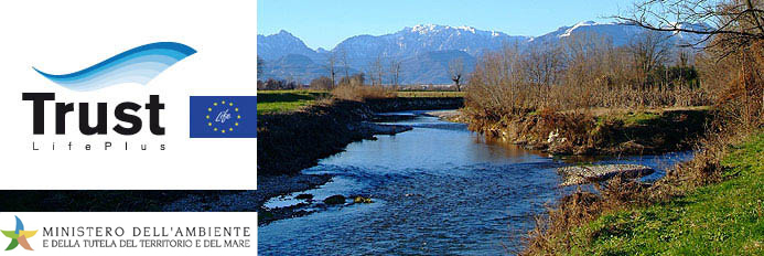
The primary goal of the TRUST project is to adapt groundwater of the Veneto and Friuli Plain to the adverse impacts of future climate change. TRUST will demonstrate innovative actions aimed at halting and reversing the slow but progressive decline of the water table in the Veneto and Friuli Plain that has been under way for the last 30-40 years. The TRUST project intends to incorporate climate change in river basin management and identify adaptation measures based on artificial aquifer recharge to mitigate the impacts of drought and water scarcity. Secondly, the TRUST project intends to build the capacity to define the objectives and measures for the aquifer recharge in the Veneto and Friuli Upper Plain using excessive surface waters (e.g. from floods). With this scope, TRUST links with European water policy, namely Water Framework Directive, Floods Directive and the European Policy on Water Scarcity and Droughts. The project will examine the aspects connected to the development of the “river basin governance” and will focus on the set-up of a group of stakeholders concerned with the management and use of the groundwater resources in the project area. TRUST also aims at increasing the knowledge base of groundwater quantitative processes in the study area through the implementation of innovative tools such as remote sensing, hydrological & groundwater models, climate change models, risk assessment and Web-GIS.
Within this project the research unit is involved in the Action 7 (Evaluation of objectives and measures for artificial aquifer recharge and cost benefit analysis) and will work on the implementation of a Regional Risk Assessment methodology (RRA) following three main steps:
- development of the methodology and of the conceptual framework;
- definition of impact and risk indicator and indices;
- construction of different scenarios using the output of the other models developed within the project as an input;
- production of vulnerability and risk maps.
The final maps will be used to compare different scenarios and make a ranking of the different intervention options.
Link: http://www.lifetrust.it
SALT – Sustainable mAnagement of the Esino river basin to prevent saline intrusion in the coastal aquifer in consideration of climaTe change
SALT overall objective is to contribute to the efficient use and protection from saltwater intrusion of groundwater resources in the lower Esino river valley. The objective corresponds to European Union policy aimed to encourage resource efficiency through more sustainable consumption patterns of water resources. Specifically, the project aims to:
- Analyse the trend of salt intrusion in the Esino River and related aquifer;
- Simulate salt intrusion under future scenario considering climate change (impact analysys);
- Define remediation actions to prevent salt intrusion increasing;
- Develope a tool which can be used to evaluate the impact of different management options on the quality and quantity of the aquifer;
- Disseminate and contribute to reproduction of proposed methodology to other costal aquifers in Marches Region and other regions in Italy and the EC.
With this objectives, SALT links with two European directives, namely Water Framework Directive and Groundwater Directive.
The activities of the unit are in the Action 6, Development and application of a Regional Risk Assessment procedure to support the aquifer management. The Action aims at developing a spatially-resolved risk assessment procedure, supporting the assessment of actual and future climatic scenarios for the Esino river basin, and thus providing a tool which can be used to evaluate the impact of different management options on the quality and quantity of the groundwater. The developed procedure will integrate vulnerability, impact and risk indicator and indices, as well as the climate and hydrogeological models results at analytical unit scale, to rank the risk for groundwater for the selected scenarios. In order to achieve this goal, the activity includes three tasks:
- the methodological development,
- the scenario construction,
- the regional risk assessment procedure development and application.
Each task will provide the input for the subsequent activity: the methodological development will identify the indicators which can be used to characterize the present and future scenarios. Finally, potential impacts to groundwater will be estimated for each scenario, allowing also the ranking of the analytical units identified in the Esino river basin.
Link: http://www.lifesalt.it
CLIM-RUN – Climate Local Information in the Mediterranean region: Responding to User Needs
CLIM-RUN aims at developing a protocol for applying new methodologies and improved modelling and downscaling tools for the provision of adequate climate information at regional to local scale that is relevant to and usable by different sectors of society (policymakers, industry, cities, etc.). Differently from current approaches, CLIMRUN will develop a bottom-up protocol directly involving stakeholders early in the process with the aim of identifying well defined needs at the regional to local scale. The improved modeling and downscaling tools will then be used to optimally respond to these specific needs. The protocol is assessed by application to relevant case studies involving interdependent sectors, primarily tourism and energy, and natural hazards (wild fires) for representative target areas (mountainous regions, coastal areas, islands). The region of interest for the project is the Greater Mediterranean area which is a recognized climate change hotspot, i.e. a region particularly sensitive and vulnerable to global warming.
Within CLIM-RUN project, the research unit is involved in WP1 (Climate Services Analysis and Support) and in WP8 (Integrated case studies) and will contribute to the following activities:
- Development of impact indicators based on wide stakeholder involvement in order to assess climate impacts and support the implementation of adaptation measures at regional and local scales;
- Development of vulnerability and impact indicators/indexes to transfer climate information to different stakeholders (e.g. policy makers, business stakeholders etc.);
- Definition of risk-based conceptual frameworks for the assessment of climate change impacts on the North Adriatic coastal zones for each sector of interest;
- Identification of sector-based climate change stressors and metrics useful to transfer climate information at the regional/local scale and to construct climate change hazard scenarios;
- Definition of vulnerable receptors/targets and vulnerability indicators matrixes associated to climate change impacts for each sector of interest;
- Exchange of knowledge on relevant climate information and identification of a subset of climate services to support climate change impact assessment in the North Adriatic coastal zones.
PEGASO – People for Ecosystem-based Governance in Assessing Sustainable development of Ocean and coast
The main objective of PEGASO is to build on existing capacities and develop common novel approaches to support integrated policies for the coastal, marine and maritime realms of the Mediterranean and Black Sea Basins in ways that are consistent with and relevant to the implementation of the ICZM Protocol for the Mediterranean.
PEGASO is consistent with the frameworks of the Barcelona and Bucharest Conventions which seek to achieve a coordinated approach to sustainable resource management and development, and to protect these regional seas and the quality of life of their peoples. It also continues ICZM efforts, supporting new marine and maritime policies.
PEGASO will use the model of the existing ICZM Protocol for the Mediterranean and adjust it to the needs of the Black Sea through three innovative actions:
- Constructing an ICZM governance platform as a bridge between scientist and end user communities, going far beyond a conventional bridging. The building of a shared scientific and end users platform is at the heart of our proposal linked with new models of governance.
- Refine and further develop efficient and easy to use tools for making sustainability assessments in the coastal zone (indicators, accounting methods and models, scenarios). They will be tested and validated in a multi_scale approach for integrated regional assessment.
- Implementation of a Spatial Data Infrastructure (SDI), following INSPIRE Directive, to organize and standardize spatial data to support information sharing on an interactive visor, to make it available to the ICZM Platform, and to disseminate all results of the project to the end users and interested parties.
The activities of the unit within the project will be articulated with the following main activities:
- review of DSSs, geographical indicators and sclimate change scenarios to be used for multiscale ICZM processes across the Mediterranean and Black Sea Basins
- development of environmental and socio-economic geographical indicators supporting hazard, vulnerability and risk assessment guiding the definition of effective ICZM and adaptation strategies;
- implementation of a GIS-based DSS for the assessment of climate change related impacts on coastal systems. The DSS will be based on an ecosystem approach that will support the application of the ICZM protocol and will be used for the North Adriatic case study.
CLIM-DAT
CLIM-DAT is a project in partnership with the Institute for Environmental Protection and Research (ISPRA) which aims at getting deepen understanding of the impacts caused by climatic changes in the coastal area of the North Adriatic Sea, using current and historical data owned by ISPRA (e.g. meteo and mareographic data). Within CLIM-DAT digital data of interest available at ISPRA (e.g. time series coming from tide gauge stations located in the Venice Lagoon and the in the North Adriatic) will be validated and organised within a specific geodatabase, and will be used to calibrate hydrodynamic and statistical models applied in the North Adriatic area and then to construct risk maps representing storm surge flooding under changing climate conditions.
All the results achieved in the project will be integrated in a GIS-based DEcision support SYstem for Coastal climate change impact assessment (DESYCO) that is aimed at the assessment of climate change impacts on coastal areas at the regional scale and will be shared with local stakeholders. The ultimate aim of the work is to improve our knowledge about climate change impacts on coastal areas at the regional scale in order to identify areas where adaptation strategies maybe required.
The project will be articulated with the following activities:
- identification of data sources useful for the project;
- collection, storing and organization of data (hydrological data, hidrodinamic data, meteo and mareographic data);
- development and integration of data within the DSS;
- analysis and assessment of the contribution of these data for calibration and validation of models and for the development of hazard and risk scenarios to be included in the DSS;
- organisation of the transfer of knowledge and dissemination activities (e.g. public workshops on climate change related issues).
CMCC-FISR – Euro-Mediterranean centre for Climate Change, Special Integrative Fund for Research
The Euro-Mediterranean Centre for Climate Change is a national research centre devoted to the study of climate change and its impacts, focussing on the Mediterranean region. The Centre main headquarters are located in Lecce and six other satellite offices are distributed in the rest of Italy. The research institutes that participate in the creation of the Centre are: INGV (National Institute for Geophysics and Volcanology, project leader), ASI (Italian Space Agency), CVR (Venice Research Consortium), FEEM (Enrico Mattei ENI Foundation), the Universities of Lecce and Benevento, CIRA (Italian Centre for Space Research).Within this project a new supercomputing centre dedicated to the development and testing of global and regional climate models has been created. Future climate scenarios will be tested at the global and regional scale, followed by the development and application of risk assessment, impact assessment and decision support system (DSS) methodologies.
What the Centre produced up to now:
- a global circulation model (0.5 x 0.5 degrees resolution) based on the coupling of the atmospheric ECHAM and oceanic OPA-ORCA models, to simulate future climate scenarios and study climate temporal variability. Sea ice, terrestrial and marine ecosystems will be integrated in the model;
- a high resolution model for the Mediterranean sea (1/16 degrees resolution);
- models to simulate the socio-economic impacts of climate change.
The modelling outputs were used to assess the climate change impacts on the economy, agriculture, on the marine and terrestrial ecosystems, on coastal areas and on human health. The Centre promoted international cooperation of its partners, that were already involved in several European research projects. The activities of the Centre were organised among the partners in nine work packages:
WP 1: Grid technologies and applications
WP 2: Numerical applications
WP 3: Socio-economic models
WP 4: Impacts on agriculture
WP 5: Risk assessment, impact assessment and DSS methodologies
WP 6: Special projects
WP 7: Training, dissemination, education
WP 8: Operations
WP 9: Administration and organization of the Centre
Work Package 5 (Venice, Italy)
ENVIROMENTAL RISK ASSESSMENT, IMPACT ASSESSMENT AND DSS METHODOLOGIES
This activity, based in Venice, is coordinated by CVR (Venice Research Consortium) whose partners for this project are CNR (National Research Council), CPSM (Tidal Forecast and Information Centre of the Venice City Council) and the University of Venice.
The main activities of the WP are here summarized:
- development of a GIS (Geographic Information System) based integrated risk assessment methodology and of an environmental impact assessment for the higher Adriatic coast;
- prioritization of the risks posed by climate change, thus supporting the identification of the most suitable mitigation and monitoring interventions;
- development of a suitable Decision Support System (DSS) framework. The DSS will support the definition of the possible interventions for impact control and mitigation at the regional scale;
- study of time series of several relevant environmental indicators for climate change. A study on the correlation between solar activity and climate will be also performed;
- investigation on the possible effects of climate change on the behaviour and distribution of persistent organic pollutants (POPs);
- development of high resolution sea circulation models, focusing on the key impacts on the coastal areas (e.g. bottom stress, coastal erosion, impacts on fishing and other human activities).
All these activities will be conducted with an extensive use of remote sensing data and the support of GIS tools. Particular attention will be given to the city of Venice, for its peculiar position and its extremely high vulnerability to a possible sea level rise.
Link: http://www.cmcc.it/
TIMBRE – Tailored Improvement of Brownfield Regeneration in Europe

Brownfield regeneration plays a key role in sustainable land use management. The 7th Framework Programme project TIMBRE (Tailored Improvement of Brownfield Regeneration in Europe) starts from the observation, that many useful and innovative remediation technologies as well as methods to support risk assessment and decision making processes for an optimized brownfields’ regeneration have been developed, but are only rarely applied using their full potential. Identified obstacles for an effective regeneration are (i) the abundance of strategies, tools, documented case studies and remediation technologies available at the EU level as well as (ii) the difficulties in adapting them to cultural, regional and site-specific requirements.
TIMBRE’s main objective is to overcome these barriers by providing brownfields’ owners, local authorities and stakeholders with a web-based problem- and target-oriented customizable decision support toolbox.
The research activities within TIMBRE focus on the methodological approach and designed activities of TIMBRE Work Package 1 that concentrated on the development of a web-based Expert System. As a crucial part of the TIMBRE toolbox, this online information centre will provide access to proven state of the art solutions for brownfield regeneration. This requires the collection, analysis and classification of accessible literature, methodologies and tools. Particular efforts will be devoted to collect and review the ecological and human health risk assessment and management methodologies and tools recognizing their key role for the evaluation and rehabilitation of brownfields.
The Expert System will offer a multi-criteria methodology for the evaluation and ranking of the collected information providing end-users with the most suitable instruments for each phase of the brownfield regeneration process. Results will be tailored to the site-specific needs taking the local priorities and requirements into account. This approach involves local experts, site owners, public authorities and engineering companies in the definition of evaluation criteria.
2-FUN – Full-chain and UNcertainty approaches for assessing health risks in FUture eNvironmental scenarios
![]()
2-FUN is a 4-year Integrated Project (2007-2011) funded within the European 6th Framework Programme and involving 12 partners from 9 European countries.
2-FUN aimed at providing decision-makers with innovative tools to analyse the current and future trends in environmental conditions and pressures that may lead to health problems. Specific scientific actions were set up to develop methodologies, databases and models on the following topics:
- Building future realistic socio-economic, environmental and health scenarios;
- Integrated exposure and effect assessment of multi-stressors via multiple routes;
- Integration of children’s issues in health risk assessments;
- Development of uncertainty models for improved health management;
- Demonstrations of a full-chain approach for health risk assessment.
2-FUN engaged in a structured dialogue with all interested parties (stakeholders, policy-makers and researchers) to monitor large environment- and health-focused scientific initiatives and to incorporate their needs in the development of tools for health risk assessment. The developed tools were tested on 3 European case studies covering a wide range of temporal, spatial, environmental, and societal contexts:
- evolution of air pollution and thermal stress in Portugal;
- assessment of the health impact of chemical contamination of a river watershed in France;
- health risk assessment of contaminated soils for children living in the industrial area of Upper Silesia region in Poland.
Our research group was involved as coordinator of WP1 – Construction of realistic scenarios, accounting for future environmental and societal changes.
A “Risk-based Tool for the Regional Ranking of Environmental Chemical Stressors” has been developed by the research group within WP1 activities, with the main aim of supporting decision-makers in the evaluation of the existing information on environmental contamination and population health status in the region of interest to identify priority chemical stressors to be investigated more urgently. Moreover, the tool allows the identification of priority areas within the considered region, where further assessment should be focused.
Link: http://www.2-fun.org
FOCUS – Antonio Marcomini on pollution, sustainability, safety
FOCUS – Antonio Marcomini on pollution, sustainability, safety
SUN PROJECT
![]() The new large EU FP7 SUN (Sustainable Nanotechnologies) project started on 1st October 2013
The new large EU FP7 SUN (Sustainable Nanotechnologies) project started on 1st October 2013
Our understanding of the environmental and health risks associated with nanotechnology is still limited and may result in stagnation of growth and innovation. There have been other technologies that revealed unexpected ecological and health effects only several years after their broader market introduction. In the worst cases this caused significant costs for society and the enterprises in the form of lock-in effects, over-balancing regulations and demolished consumer confidence.
On 1 October 2013 the SUN (Sustainable Nanotechnologies) project started. The 3.5 year EU project, worth 14.5 million euro, is coordinated by Prof. Antonio Marcomini from the Department of Environmental Sciences, Informatics and Statistics of Ca’ Foscari University of Venice (Italy) and involves 35 partners from 13 European countries as well as an international Advisory Board including 11 experts from academia, industry and regulatory bodies.
SUN is based on the hypothesis that the current knowledge on environmental and health risks of nanomaterials, whilst limited, can nevertheless guide nanomanufacturing to avoid future liabilities, provided that an integrated approach that addresses the complete product lifecycle of production, use and disposal is applied.
The concept of SUN is to combine Risk Assessment and Lifecycle Assessment to develop a user-friendly, versatile software-based Decision Support System (DSS) for practical use by industries and regulators. The industrial partners in the SUN consortium will evaluate and “reality-check” the DSS against real industrial case studies in terms of cost/benefit and insurance risk. This validation will culminate in guidelines for safe nanoscale product and process design. As a “by-product” SUN will identify needs for future research and assign priorities for current regulation. Major international stakeholders will be involved in implementing the SUN results into practice and regulation. In this way SUN will enable more sustainable nanomanufacturing processes, it will result in more solid risk prevention and mitigation strategies, and it will be easily applicable to different materials and industrial settings
Sustainable Nanotechnologies has passed the second assessment, first in his group, so it will be funded with about 10.3 million euros
About 10.3 million euros of EU funding, 35 partners including Universities, Research Institutes and industries, a ‘board’ that involves international renowned experts, especially outside Europe. Here are some figures for the project SUN-Sustainable Nanotechnologies, which has as its leader the Ca ‘Foscari University and as coordinator Prof. Antonio Marcomini of the Department of Environmental Sciences, Informatics and Statistics.
DESYRE – DEcision Support sYstem for REhabilitation of contaminated sites
A new challenge in urban management is nowadays represented by the remediation of large contaminated industrial facilities. Different examples of these industrial sites are widespread in the European territory, from the Netherlands (e.g. the Port of Rotterdam) to Germany (the mining site of Bitterfeld) and the Eastern countries (e.g. the Tarnowskie Gory plant site in Poland). These sites, defined as megasites, are characterized by complex contamination patterns, several stakeholders’ involvement and high costs for total clean-up procedures. Their relevance is posed by the social, economic and also environmental benefits derived by their remediation and their new economic development.
Therefore, the definition of specific tools and strategies, that can help manage megasites complexity, is required. Specifically, the integration of all the different management aspects is a primary requirement: the consideration of the actual risk, the selection of the best technological options for site remediation, the socio-economic drivers or constraints, the planning issues, are among the significant aspects which are to be strongly taken into consideration. Equally, the active involvement of all the stakeholders in the decision process is another important requisite in order to successfully accomplish management objectives.
In this communication we present the experience gathered in the management of the Porto Marghera site, through the development of a decision support system called DESYRE. Porto Marghera, near the city of Venice in Italy, is the largest contaminated site of national interest (approximately 3500 hectares). The main productions are represented by petrochemical and chemical plants; spread contamination affects soil and groundwater.
The regulatory framework is represented by the Program Agreement on Chemistry (1998), signed by several stakeholders, and the Master Plan (2001), based on a risk minimization approach. In order to address the management of a complex megasite such as Porto Marghera, the DSS DESYRE (DEcision Support sYstem for REhabilitation of contaminated sites) has been developed. In fact, it has been successfully tested in two areas of the Porto Marghera site. DESYRE is a GIS-based software composed of five interconnected modules.
In the characterisation module, chemical and hydrogeological data are organized in a relational database and contaminants distributions are mapped by using geostatistic tools.
- The socio-economic module addresses the socio-economical constraints though a Fuzzy Logic analysis, until the selection of the best land use.
- The risk assessment module is divided into two phases. In the pre-remediation phase, an original procedure allows to assess and represent the spatial distribution of risks posed by contaminants in soil and groundwater, providing a risk-based zoning of the site.
- Then, in the technology assessment module, a selection of suitable technologies and the creation of different technology sets, taking into account both technical requirements and site-specific features, is performed by experts supported by Multi-Criteria Decision Analysis tools. In the post-remediation risk assessment, a simulation of applied technologies provides residual risk maps with related uncertainty maps.
- Finally, in the decision module, alternative remediation scenarios are described by a set of indices; the scenarios can be compared and ranked by the interested stakeholders using Multi-Criteria Decision Analysis methodologies.
SYRIADE – Spatial decision support sYstem for RegIonal Assessment of degraded Land
The overall objective of the system is the ranking of potentially contaminated sites for priority of investigation, when no information on characterization and risk by site specific methodologies is available. This way, the system is intended to address not only the requirements of the Soil Thematic Strategy, but also a general and ordinary goal of regional authorities, i.e. to manage their contaminated sites in the most cost-effective way, by concentrating on those areas that could be pose a risk to human health and the environment.
To reach the objective, the system performs a prioritization of contaminated sites based on the environmental risk estimated through a regional risk assessment, and on a socio-economic relevance analysed through indicators of recovery potential. Three main components are identified: the environmental (risk assessment) and the socio-economic (recovery potential), leading towards to the ranking of sites (integrated management).
The three Modules of the system reflect the following components:
- a module for the regional risk assessment (environmental analysis);
- a module for the socio-economic analysis (recovery potential);
- a module for the integrated management and final ranking.
The first Module (Regional Risk Assessment) includes functionalities that allow a first ranking of potentially contaminated sites to be performed, only considering environmental aspects, such as a sites hazard and receptors vulnerability. Additionally for the mining waste sites, the risk of subsidence i.e. the movement of the surface resulting from the collapse of overlying strata into main voids (physical risk) is taken into account using a specific ranking.
The main output of the Regional Risk Assessment Module is a ranking of the potentially contaminated sources or sites based on the potential regional risk score.
The second Module (Socio-economic Assessment) is aimed at providing a score for each administrative unit (or NUT) based on socio-economic indicators such as unemployment, GDP, population density, land use, and infrastructure. A score is assigned to each administrative area.
The third Module (Integrated Management) integrates the outputs of the previous two Modules, in order to provide a prioritization of sites based on the potential environmental regional risk and the socio-economic priorities. The latter Module allows also the definition of integrated management areas, characterized by the combined outcomes of environmental and socio-economic analyses.
The project was funded by the EC Joint Research Centre in Ispra (contract n. 381502 FISC).
Sino Italian Environmental Regional Risk Assessment (SIERRA) Project
SIERRA Project was funded by the Italian Ministry for Environmental Protection and developed in collaboration with the Chinese Research Academy of Environmental Sciences (CRAES; Beijing, China); started in 2009 and lasting 3 years.
The project fits with the proposing definition of a contaminated land management approach in China, providing support for the definition of a framework for the management of these critical issue in the country, taking into account risk assessment methodologies, regional-based approaches and technological progresses, as well as international distinguished experiences. Accordingly, in the light of developing regulatory and management approaches to the problem, the reference to international experiences, specifically in Europe, provides an important resource of information and tools.